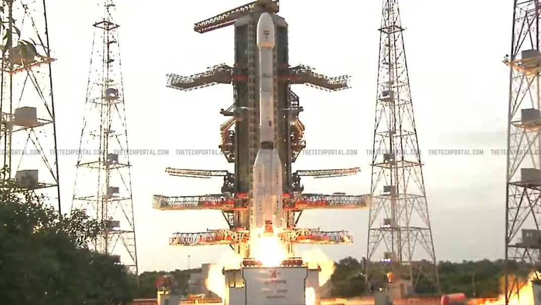

India successfully launched the NASA-ISRO Synthetic Aperture Radar (NISAR) satellite on July 30, 2025, at 5:40 PM IST from the Satish Dhawan Space Centre in Sriharikota. The satellite was carried into space by the GSLV-F16 rocket. The spacecraft has successfully separated from the third stage of the launch vehicle and will soon deploy its solar arrays to power up. Once stabilized, NISAR will move into its final Sun-synchronous orbit at an altitude of 747 km to begin its next phase – commissioning, calibration, and eventually, science operations.
The satellite weighs around 2,392 kilograms and has been built to function for at least three years, with a possibility of extension. Its radar antennas include a large 12-meter-wide mesh reflector that will unfold in space during the satellite’s commissioning phase. Over the next 90 days, ISRO and NASA teams will complete system checks, deploy instruments, and begin calibration processes. And after the completion of the commissioning and calibration phase, full science operations are expected to begin by late October 2025.

Notably, NISAR is a joint mission between the Indian Space Research Organisation (ISRO) and the United States’ National Aeronautics and Space Administration (NASA), aimed at providing accurate, real-time data on changes in Earth’s surface, climate, and natural disasters. The NISAR satellite is one of the most advanced Earth observation missions, using two radar systems – ‘L-band’ from NASA and ‘S-band’ from ISRO. These radars work together to capture detailed images of Earth’s surface and can detect ground movements as small as one centimeter.
NISAR will orbit Earth 14 times a day, and it will collect critical data on various environmental and geological processes like melting glaciers, rising sea levels, forest degradation, soil moisture, earthquakes, landslides, and more. Importantly, the satellite’s ability to deliver this data quickly is one of its strongest features. Most information will be available to the public within one to two days, and in the case of emergencies like floods or earthquakes, data can be released within hours to assist disaster response teams.
The mission is expected to cost around $1.5 billion, making it the most expensive Earth observation satellite project so far. NASA contributed around $1.2 billion for the L-band radar, electronics, and satellite integration, while ISRO provided the S-band radar, launch vehicle, satellite platform, and will manage daily operations from ground stations in India. Both agencies will share data and collaborate on research and analysis.
This is not the first collaboration between ISRO and NASA. In June 2025, Indian astronaut Shubhanshu Shukla flew to the ISS on Axiom Mission 4, a private mission organized by Axiom Space in collaboration with NASA and ISRO, during which he conducted experiments designed by Indian institutions. Earlier in July 2023, NASA supported ISRO’s Chandrayaan‑3 mission by providing Deep Space Network tracking and contributing a Laser Retroreflector Array, which was installed on the Vikram lander for precise lunar measurements.
The Tech Portal is published by Blue Box Media Private Limited. Our investors have no influence over our reporting. Read our full Ownership and Funding Disclosure →